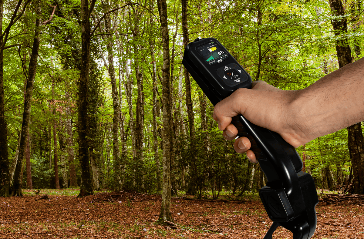
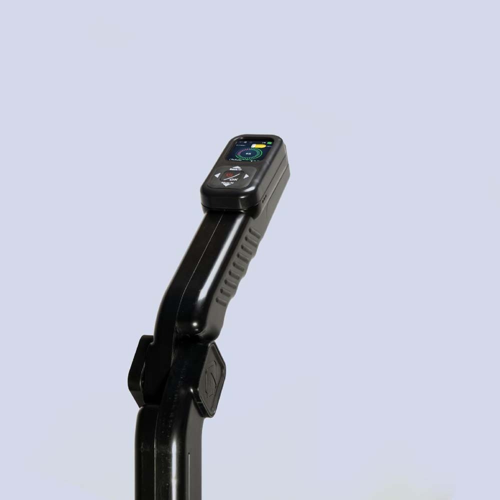

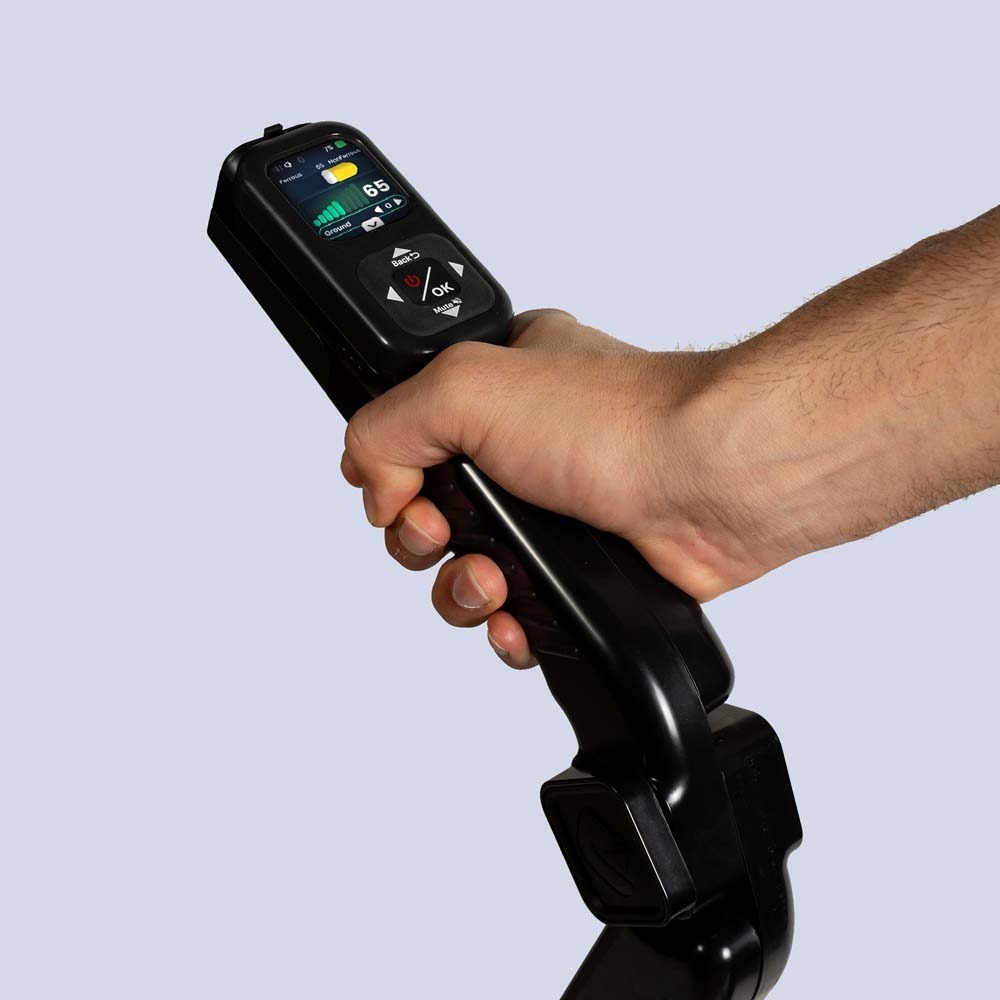

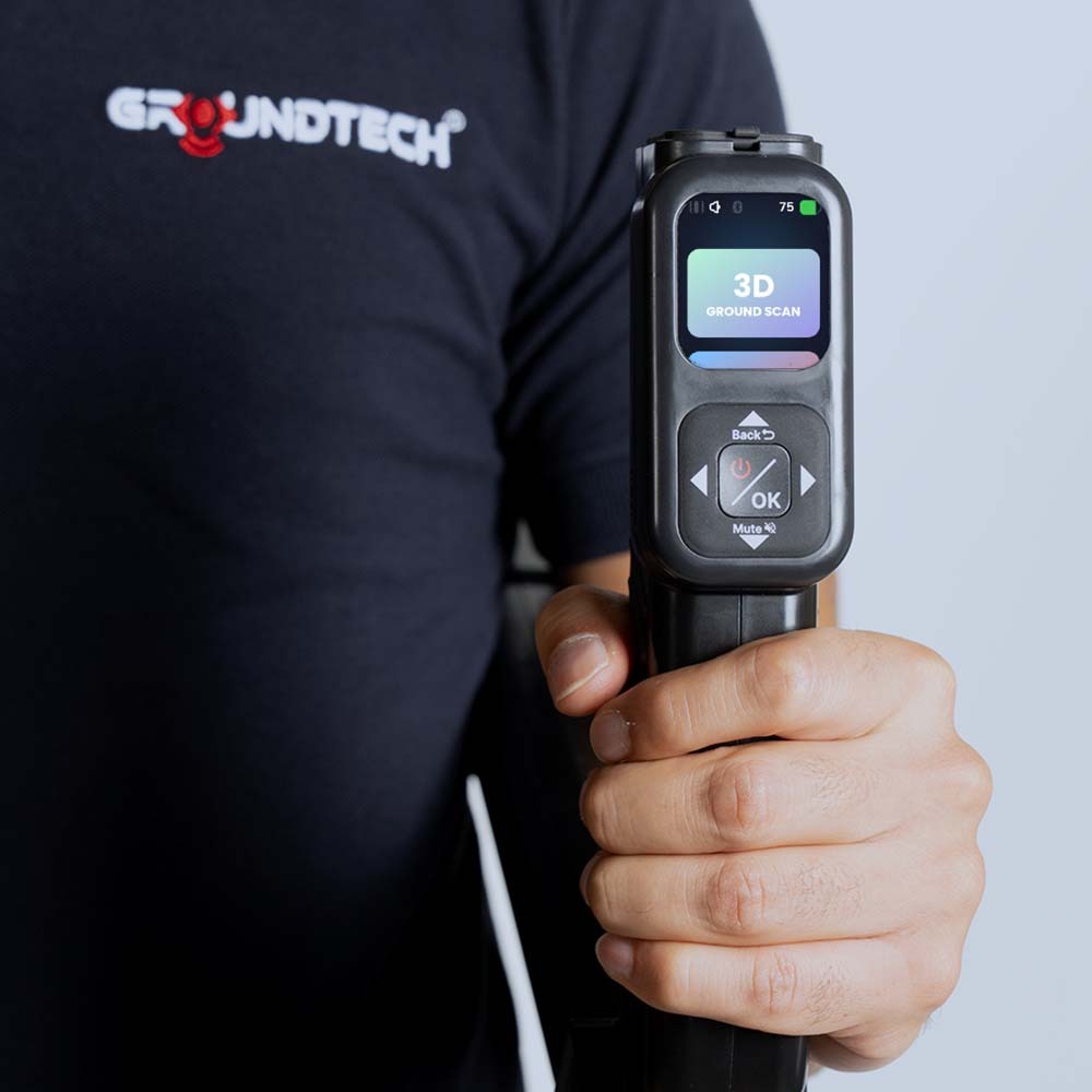
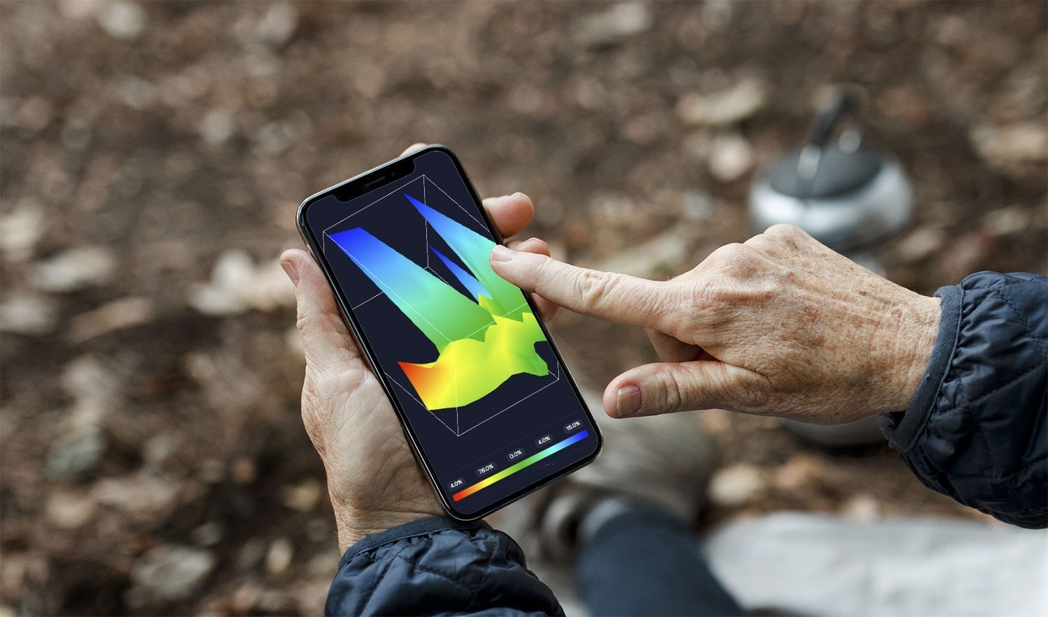
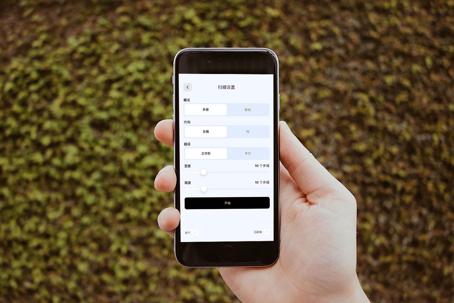
The Groundtech GR-4 Detector is a high-performance ground scanning and metal detecting system offering deep 3D analysis, intuitive controls, and multi-mode scanning features to reliably locate metals, cavities, underground structures, and anomalies with precision and clarity
- Email: krbmetaldetectors@gmail.com
- 9676369999
- Address : RR HOMES 502, Red Rose Group, Mehdipatnam
☰
Brands
OKM DETECTORS ›
VERTEX DETECTORS ›
PROTON DETECTORS ›
NOKTA - MAKRO DETECTOR ›
GER DETECTORS ›
GEO GROUND DETECTORS ›
MEGA LOCATORS ›
GOLDXTRA DETECTORS ›
ASYA DETECTORS ›
DRS PRODUCTS ›
DETECTOR GR ›
OKM DELTA RANGER
EVOLUTION NTX
EXP 6000 PRO
EXP 6000 PRO PLUS
OKM eXp 7000 Professional Plus
Exp 4500 Light
Exp 4500 Professional
Exp 4500 Professional Plus
Fusion Light
Fusion Professional
Fusion Professional Plus
OKM Rover UC
ROVER C-4
EVOLUTION NTX
Gepard GPR 3D
Pulse Nova
Fortuna XELA
GEO SEEKER WATER DETECTOR
MINI GEOSEEKER
Bionic X4
PROTON ELIC RB-1 M5
PROTON ELIC RB-1 M4
PROTON ELIC RB-1 M3
PROTON ELIC RB-I 2 IF SPECIAL
PROTON ELIC RB-1 128 DRONE
PROTON ELIC LB - 16
PROTON ELIC LB-8
PROTON ELIC LB NORTON
PROTON ELIC LB-4S SPECIAL MILITARY
PROTON ELIC LB-2S SPECIAL MILITARY
PROTON ELIC STANDARD
NEW PROTON ELIC BRN-I KOP 8
PROTON ELIC BRN-I KOP 4 NEW
PROTON GOLD HUNTER PI SYSTEM
RIVER G 3
Titan X13
TREASURE WAY
UIG Gold Digger Detector
UIG Ground Scanner Detectors
UIG Watch Detector 3D Imaging System
Diamond Hunter Smart Device
River F Plus Water Detector
Fresh Result 1 Water Detector
Fresh Result 2 Water Detector
Titan GER 1000 Detector
UIG Pointer Detector
Golden Way Detector
Gold Seeker Detector
Gold Hunter Smart Detector
Easy Way Smart Detector
Titan 500 Smart Device
Titan 400 Smart Detector
Deep Seeker Detector
☰
Categories
METAL DETECTORS ›
GOLD METAL DETECTORS ›
3D METAL DETECTORS ›
3D GROUND SCANNERS ›
LONG RANGE GOLD LOCATORS ›
LIVE IMAGING GOLD DETECTORS ›
DIAMOND & GEM DETECTORS ›
GPR SYSTEMS ›
PULSE INDUCTION METAL DETECTORS ›
PIN POINTER ›
WATER DETECTORS ›
MEGA SCAN PRO 2024
Gold Stinger X5
Golden Mask Deep Hunter pro 7
MEGA SCAN PRO NEW EDITION 2024
Gold Stinger X5
Golden Mask Deep Hunter Pro 7
Golden Mask Deep Hunter Pro 7se
Golden Mask HF1000
UIG Ground Scanner Detectors
UIG Gold Digger Detector
Via Gold A9 Area Scanning Gold Detector
A6 Plus Gold Detector
Asian K-37 Detector
Area Scanning Device Avcı E-80
Model 16 Area Scanning
Via Gold Detector 60x60 Head
Via Gold Detector
Via Gold A9 Detector with Display Features
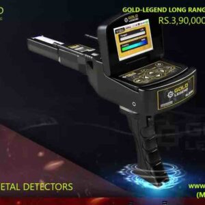
Gold Legend
Titan 500 Smart Device
Gold Seeker Detector
Golden Way Detector
Impact Metal Detector
PDX-2 Gold Long Range Detector
LDX-2 Gold Long Range Detector
LDR Digital 2 Gold and Diamond Detector
Gold Vision
Gold Hunter Smart Detector
Infinity Max Pro
Gold Star 3D Scanner
Phoenix
Viper
Cobra GX 8000 Plus
Aurelian
Concord
Deep Seeker Detector
Titan GER 1000 Detector
Titan 400 Smart Detector
OKM Delta Ranger
EXP 6000 Pro
EXP 6000 Pro Plus
OKM eXp 7000 Professional Plus
Exp 4500 Light
Gold Scan III
Gold ID-XL
Exp 4500 Professional
Exp 4500 Professional Plus
Fusion Professional
Fusion Professional Plus
OKM Rover UC
Rover C-4
Evolution NTX
Gepard GPR 3D
Pulse Nova
Proton Gold Hunter PI System
Bionic X4
INVENIO PRO
Adrenalin Z18 Professional
Deep Seeker Detector
OKM DELTA RANGER
PRORADAR X1
INVENIOJEOHUNTER 3D Dual System
Stealth Scanner
Adrenalin Secret Imager
Adrenalin Visionary
Ground Exper Pro
Water Fall
Gold Step Pro Max
Royal Analyser Pro 6000
Advanced Resistivity Scanner (ARS)
Proradar X5
Proradar X1 Pro
Ground Exper Light
OKM Delta Ranger
PROTON ELIC RB-1 M5
PROTON ELIC RB-1 M4
PROTON ELIC RB-1 M3
PROTON ELIC RB-I 2 IF SPECIAL
PROTON ELIC RB-1 128 DRONE
PROTON ELIC LB - 16
PROTON ELIC LB-8
PROTON ELIC LB NORTON
PROTON ELIC LB-4S SPECIAL MILITARY
PROTON ELIC LB-2S SPECIAL MILITARY
PROTON ELIC STANDARD
NEW PROTON ELIC BRN-I KOP 8
PROTON ELIC BRN-I KOP 4 NEW


Reviews
There are no reviews yet.